OS Map of St Margaret's at Cliffe. 1950-1960

OS Map of St Margaret's at Cliffe. 1950-1960
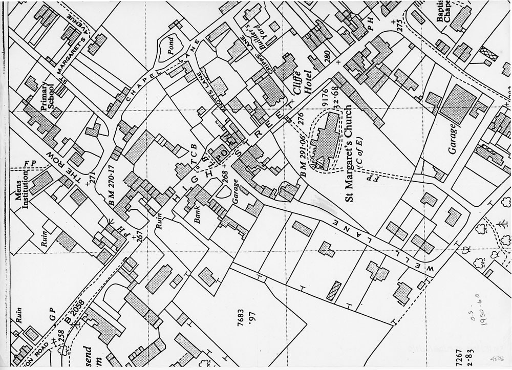
Copy of an Ordnance Survey map of St. Margaret’s-at-Cliffe 1950-1960 with Well Lane shown fully and just the beginning of Vicarage Lane.
Subject
Maps (46)
Village Centre Views (104)
Date of coverage
1950-1960Place
St. Margaret's-at-Cliffe, Well LaneReference number
MARG.02161Format
Still image (3732)
License
Creative Commons Attribution-NonCommercial-NoDerivs (CC-BY-NC-ND)Search by text
You can carry out an advanced search of the archive by search term.
Search by subject
Browse by century:


No Comments
Add a comment about this page