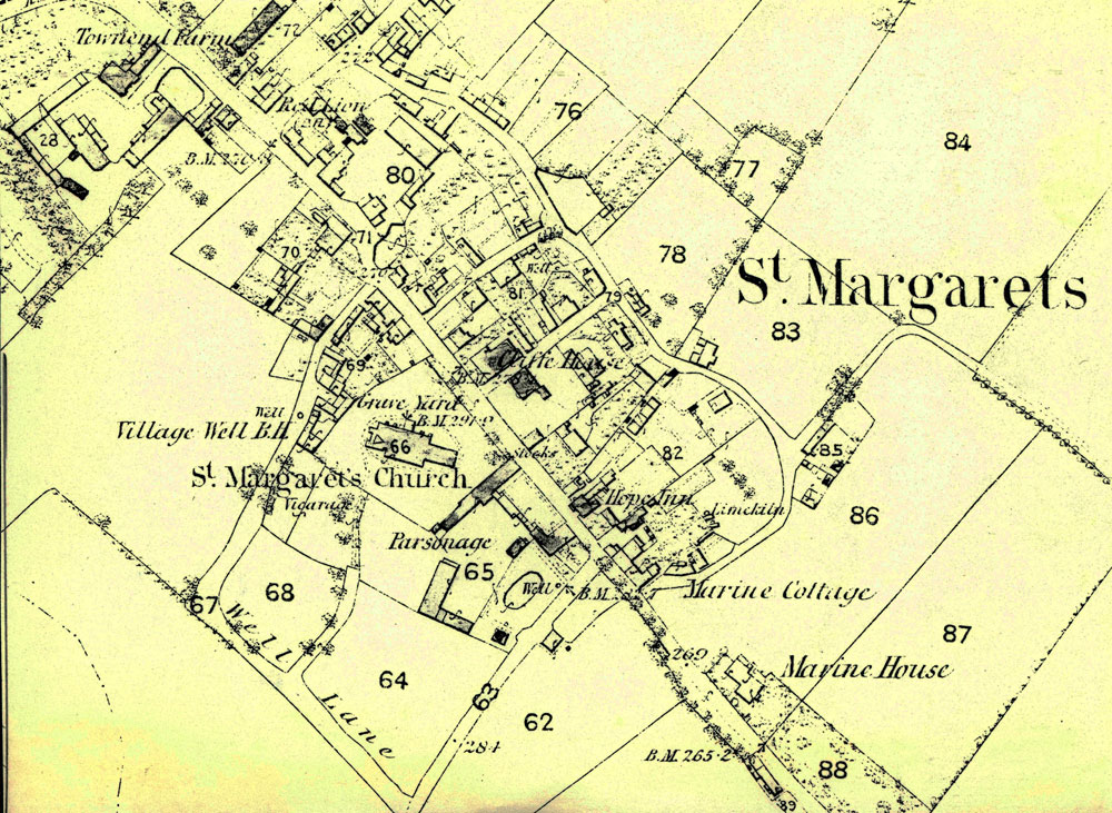
OS Map Centre of St Margaret's at Cliffe. 1862 (1872 revision)
")
OS Map Centre of St Margaret's at Cliffe. 1862 (1872 revision)
Section of Ordnance Survey map 1862 (1872 revision) showing the centre of St Margaret’s at Cliffe.
Subject
Maps (46)
Parsonage Farm (12)
Townsend Farm (35)
Date of creation
1862 - 1872Date of coverage
1862 - 1872Place
St Margaret's at CliffeReference number
MARG.03312Format
Text (691)
Keywords
Townsend Farm (27)
License
Creative Commons Attribution-NonCommercial-NoDerivs (CC-BY-NC-ND)Search by text
You can carry out an advanced search of the archive by search term.
Search by subject
Browse by century:


No Comments
Add a comment about this page