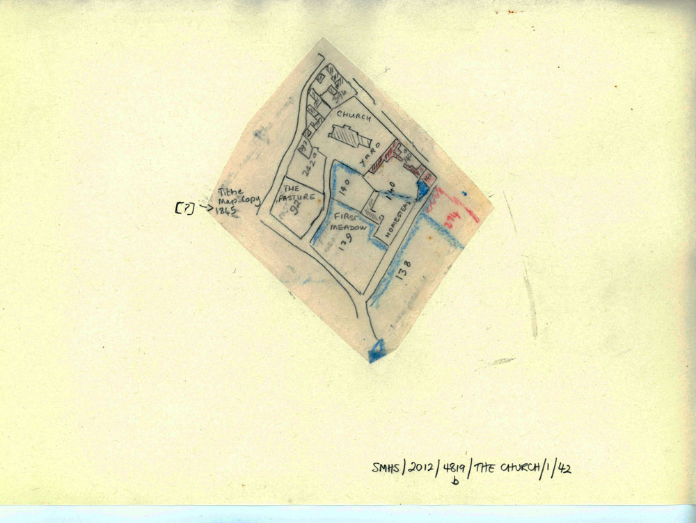
1840 Tithe Map showing land use around the church. zoom1840 Tithe Map showing land use around the church. zoom1840 Tithe Map showing land use around the church.Tracing of a section of Tithe Map 1840 showing land use around the church. Annotated in pencil. Typescript notes attached.Subject High Street (448)Maps (46)The Village Church (270) Date of creation 1840 Date of coverage 1840 Place St Margaret's at Cliffe, High Street, St Margaret's Church Reference number MARG.01334 Format Still image (3732) License Creative Commons Attribution-NonCommercial-NoDerivs (CC-BY-NC-ND) No CommentsStart the ball rolling by posting a comment on this page! Add a comment about this pageYour email address will not be published. Required fields are marked *Your comment:Name * Email * I consent to my name and e-mail address being stored along with this comment, and to the website editors communicating with me by e-mail about the comment if necessary. My name may be published alongside the comment on the website, but my e-mail address will not be published. My information will not be shared with any third party (see our Privacy Statement - opens in a new window). * Δ Search by textYou can carry out an advanced search of the archive by search term.Try an advanced searchSearch by formatStill image (3732)Text (691)Sound (6)Moving image (1)View all formatsSearch by subjectSt Margaret's Bay (811)Memorials in St Margaret at Antioch Church and graveyard (702)Postcards (671)High Street (448)World War Two (378)The Village on the Beach (376)The Village Church (270)Reach Road (241)Gordon Denoon Album (163)Village Shops (155)View all subjectsBrowse by century:30th (1 page)22nd (1 page)11th (3 pages)12th (3 pages)13th (5 pages)14th (6 pages)15th (5 pages)16th (6 pages)17th (12 pages)18th (30 pages)19th (331 pages)20th (1632 pages)21st (357 pages)Share thisFacebookPinterestTwitterLinkedin


No Comments
Add a comment about this page