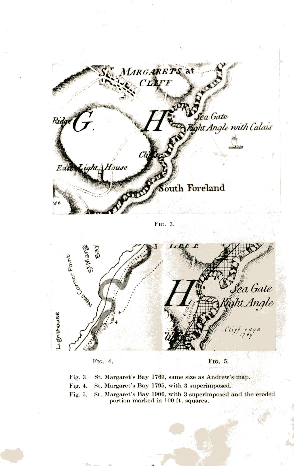
Small maps of St Margaret's Bay. c 1769-1906

A3 card mounted with three depictions of St Margaret’s Bay marked on reverse ‘Bay Map’.
Captioned below maps:
Fig 3 St Margaret’s Bay 1769 same size as Andrew’s map;
Fig 4 St Margaret’s Bay 1795 with 3 superimposed;
Fig 5 St Margaret’s Bay 1906 with 3 superimposed and eroded portion marked in 100ft squares
(N. B. This is in fact an extract from a much longer article in Archaeologia Cantiana Vol. LIV of 1941 (pp. 35 – 40) reporting on the transactions of the Kent Archaeological Society for that year which compares the Andrews, Dury and Herbert map of 1769 with later maps including Ordnance Survey map no 1. The article is by Cecil Knox and is entitled ‘St Margaret’s Bay, and the Roman Roads from Richborough to Dover and Canterbury’. All the maps may be seen more fully (unedited) in this article).
Subject
Place
St Margaret's Bay, The BayCopyright
Kent Archaeological SocietyReference number
MARG.00129Format
License
Creative Commons Attribution-NonCommercial-NoDerivs (CC-BY-NC-ND)You can carry out an advanced search of the archive by search term.


No Comments
Add a comment about this page