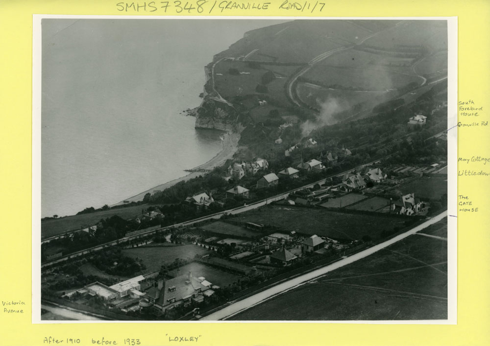
Aerial view of Granville Road, The Droveway and the Bay. 1910-1933

Aerial view of Granville Road, The Droveway and the Bay. 1910-1933
A black and white aerial photograph of The Bay with Granville Road across the centre and Droveway in the foreground. The date given is between 1910 and 1933.
Subject
Granville Road (116)
St Margaret's Bay (811)
The Droveway (97)
Place
St Margaret's BayReference number
MARG.02419Format
Still image (3732)
Keywords
St Margaret's Bay (162)
License
Creative Commons Attribution-NonCommercial-NoDerivs (CC-BY-NC-ND)Search by text
You can carry out an advanced search of the archive by search term.
Search by subject
Browse by century:


No Comments
Add a comment about this page