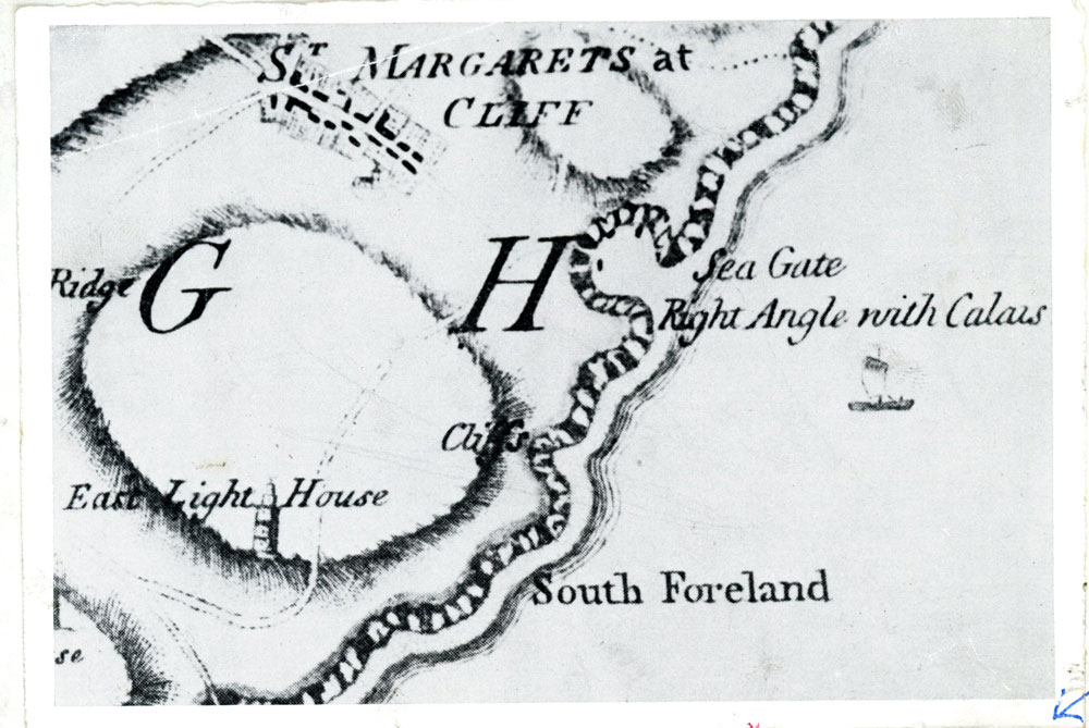
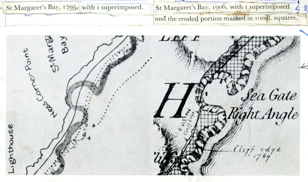
Maps of St Margaret's Bay 'Seagate', 1769 and 1906
Copies of maps dated 1769 ( Andrews, Drury and Herbert map) with the 1906 shoreline superimposed on the latter, clearly showing the reshaped coastline as a result of the erosion that has taken place. The ‘Seagate’ which was gone by at least 1906 formed a small sheltered anchorage.


No Comments
Add a comment about this page